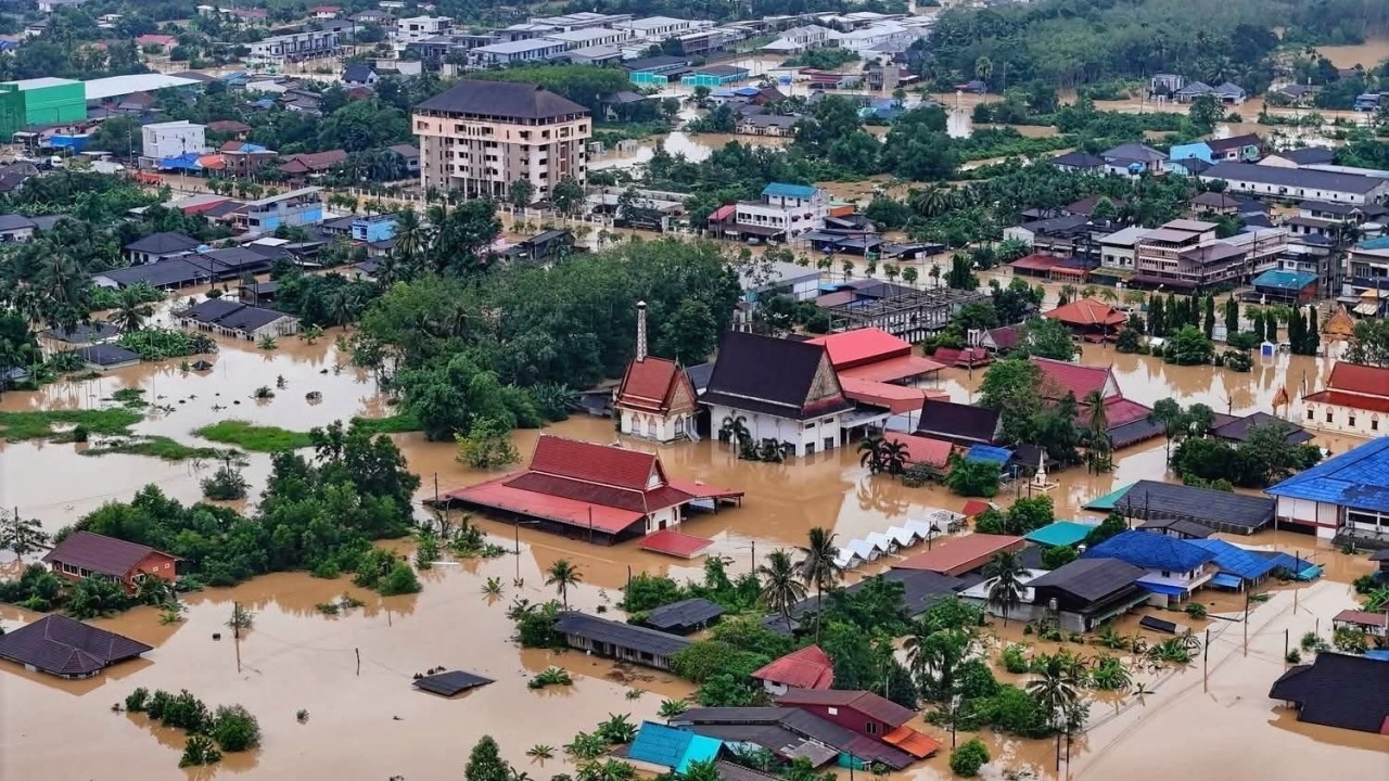
"Hat Yai Flooding" Water levels are critical, reaching head-high levels, affecting more than 150,000 people.
On November 25, 2015, the GISTDA Facebook page, Geo-Informatics and Space Technology Development Agency (Public Organization), released a map of the "Hat Yai Flood" area in Songkhla Province, along with a message stating that GISTDA has analyzed the flooding situation in Hat Yai District, Songkhla Province, using the HAND Model (Height Above Nearest Drainage) technique and Sentinel-1A satellite data from November 24, 2015, to assess water depth. This assessment aims to support relevant agencies in their relief efforts. The analysis indicates severe and widespread damage, particularly to infrastructure and the livelihoods of local residents, as follows: Public: Approximately 150,230 people have been affected. Residences: Over 25,102 households have been affected. Important locations: 47 schools and 8 hospitals have been affected. Transportation routes: A total of 536 kilometers have been affected. Most critically flooded areas are located in the dark blue zone. Analysis and map classification by shade indicate the urgency of relief efforts. Due to the high-risk flooding levels in most areas, as follows: Light Blue Zone (0.5-1 meter): Water level reaches waist-high. Dark Blue Zone (2-3 meters): Water level reaches head-high (found in most areas of Hat Yai District). Very dark/almost black Zone (more than 4 meters): Water level is very deep. It should be emphasized that most areas in Hat Yai District are experiencing flooding at the dark blue zone (2-3 meters), which is extremely high and indicates a danger to life and property. GISTDA has forwarded this analytical data set to the primary agency responsible for disaster management to use as a key database for decision-making and urgent operations.